PAS 128:2014 PDF Download
Standard EN Sample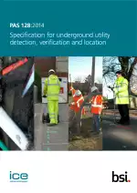
Specification for Underground Utility Detection, Verification and Location
Also Known As:
PAS 128:2014 is a standard that provides a method for accurately mapping underground utility networks. It is intended for practitioners such as surveyors, geophysicists, and subsurface utility engineers, as well as clients including engineers, constructors, and project managers, and utility owners.
The purpose of using this standard is to specify requirements for the detection, verification, and location of existing and new underground utilities. It applies to active, abandoned, redundant, or unknown utilities, regardless of their location. The standard sets out the accuracy and quality expectations for the data captured and provides a means to assess the confidence that can be placed in the data.
The standard covers various aspects including project planning, classification system for quality levels, desktop utility records search, detection, verification, location, and deliverables. By utilizing PAS 128:2014, stakeholders can make informed decisions using more complete and up-to-date data, which can reduce conflicts, delays, utility service disruptions, redesigns, personal injuries, and even loss of life. Accurate mapping of utility networks can also lead to benefits such as improved asset modeling capabilities and the potential use of remote robotic techniques for maintenance purposes in the future.
| Descriptors | Underground, Underground structures, Data, Electric cables, Quality, Verification, Surfaces, Pipes, Classification systems, Manholes, Planning |
| ICS Codes | 91.140.01 - Installations in buildings in general 93.030 - External sewage systems |
| Language(s) | English |
| ISBN | 978 0 580 79824 5 |
| File Size | 11.8 MB |